Mostaganem is a port city on the Mediterranean Sea in the north-west of Algeria, 365km from the capital, Algiers. The city is the capital of the province of the same name. At the last census in 2008 the city of Mostaganem accounted for 145,696 inhabitants. The city was founded in the 11th century AD but the town has origins dating back to the Punic and Roman times. Mostaganem was occupied first by the Phoenicians who gave it the name of Murustaga then by the Romans who gave it the name of Cartenna. In 1511 the Spaniards imposed a treaty of capitulation to the city of Mostaganem. The population lanca a call for help to the Ottoman Empire, which sent Admiral Barbarossa, who conquered the city in 1516. Mostaganem Devena a den of Corsair and remained under the control of the Ottoman Empire until the invasion French 1833.
A Street in Mostaganem
The city is divided in two by a ravine of the river Ain Sefra with the modern city in the southwest, and the old Muslim city, Tidgit, northeast. New, modern and some colonial-style buildings are added to this growing city. The new highway from the capital Algiers to Oran allows easier access to Mostaganem by road from the capital étand As Mostaganem has no airport.
The University of Mostaganem
The city is home to Abdelhamid Ibn Badis University of Mostaganem which was founded in 1987. The university has seven university sites around the city. Abdelhamid Ibn Badis University Figure cing among the largest universities in the country. Mostaganem has several public schools including 59 elementary schools, 25 colleges and 10 high schools.
The City Hall of Mostaganem
Mostaganem has a very important agricultural potential and is located near the large port and gas oil Arzew. The city has a fairly limited commercial port structure but has recently experienced an intense activity due to the decision of the Ministry of Transport to choose the port of Mostaganem among several other Algerian ports to relieve tension on the port of Algiers. A fishing port and marina were recently carried out at the Salamander.
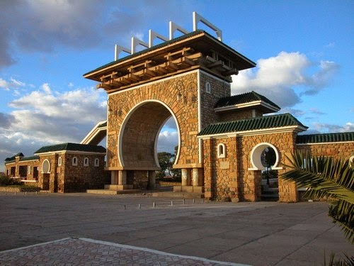
Lighthouse located in Cape Ivi Mostaganem
City Mostaganemen has significant tourism potential with its numerous beaches. It has several resorts which the best known are the Salamander Sablettes and Cap Ivi.
Two parks to visit during your visit to Mostaganem:
- 20-Aug Park (El Arsa) which is situated above the city center, this park was made in the wake of independence.
- The public garden Emir Abdelkader who embraces the City Hall. This garden was built in the early twentieth century along the City Hall. This garden was considered the finest botanical garden in all of western countries.
The beach Sablettes
The city has several museums open to the public. - The Museum of Dar El Kaid: This museum is dedicated to popular arts. - Museum of Mujahid: The museum is located on the square of the Revolution and is devoted to the war of revolution against the French colonizers. - The museum of the mausoleum of Bey Bouchlaghemet his wife Lalla Aichouche. - For archaeological and art native of Mostaganem region, a museum is under construction and will be open to the public soon.
Gate of Arsa
Lighthouse in the middle of the sea
The monument of Mazagran
The marabout Sidi Lakhdar
The monuments and historic buildings in the city of Mostaganem - The City Hall: Designed by architect French Monthalant, the town hall was inaugurated July 10, 1927 by Mayor Adrien Lemoine. - The Great Mosque: The mosque was built in 1340 by Sultan Marinid Abu al-Hasan Ali ibn Othman. The building was completely restored in 1998. - The Fort Storks (Bordj El Me Hals) is a fort built in 1082 and restored by the Ottomans. - The Church of St. Eugene Baptiste is since 1970 the Badr Mosque and a public library. - The Protestant Temple: Currently occupied by an association. - The Tomb Sidi Abdallah. - The river port Quiza. - The old fire of genius. - Dar el Kaid museum which was the former residence of the representative of the Bey of Mascara. - Dar El Abd Hamid is a house of the former emir of the Ottoman beylik. - Dar El Mufti is a Demeur which was inhabited by the Mufti of Mostaganem Kara Mestapha. - The tombs of Bey Mustapha El Ahmar. - Dar Choâra says Poets Palace which was built in 1732. - The walls of the city.
The city of Tlemcen is located in the northwest of Algeria 170 km southwest of Oran, 520 miles southwest of Algiers, Morocco and the border 76 km east of the city Moroccan of Oujda. Tlemcen, erected in the hinterland, is distant 40 km from the sea.
The city is the capital of the province of Tlemcen. Its name comes from the Berber Tala imsan, the name is sometimes spelled Tlemsan or Tilimsen, the city is also nicknamed "The Pearl of the Maghreb" or "The City of Cherries".
Area: 9061 km2 Number of municipalities: 53 Number of daïras: 09 Name daïras: Maghnia Remchi, Ghazaouet Nedroma, Mansura.
Main towns: Fetah Ain, Ain Fezza, Aïn Ghoraba, Ain Kebira, Ain nehala, Aïn Tallout, Ain Youcef, Amieur, Azails, Bab El Assa, Beni Bahdel, Beni Boussaid Beni Mester, Beni Ouarsous, Beni Semiel, Beni Snous, Bensekrane, Bouhlou, Chetouane, Dar Yaghmouracene, Djebala, Aricha, El Bouihi, El Fehoul El Gor, Fellaoucene, Ghazaouet, Hammam Boughrara, Hennaya, Honaine, Maghnia, Mansoura, Marsa Ben M'Hidi, Msirda Fouaga, Nedroma, Oued Chouli, Ouled Mimoun Ouled Riyah, Remchi, Sabra, Sebaa Chioukh, Sebdou, Abdelli Sidi Sidi Djillali, Sidi Medjahed, Souahlia, Souani, Souk El Khemis, Souk Tlata, Tianet, tirni Beni Hediel, Tlemcen Zenata
. Relief: continental climate; Traras mountain chains, mountains of Tlemcen, Sebdou; Lsser wadis, Tafna; rainfall 500 mm / year.
The Place to visit Tlemcen
From a distance the Minaret of Mansura
The Remains of Mansura Tlemcen
The historical site of Mansura is a place to visit during your stay in Tlemcen. Currently there are only the northern and western parts of the city walls and the mosque.
The walls, a development of four meters, delineated an area of 100 ha. Mud, thick 1.50 m high and 12 m, flanked by 80 towers, they nearly disappeared in the east and south.
Mansura mosque was built around 1303 by Sultan Abu Yacoub. At his death the construction works are suspended and will resume when the year 1336.
The mosque occupies a rectangle 60 meters wide and 86 meters long. The entrance of the main mosque at the base of the minaret. The yard is 30 square meters wide. The walls of 1.50 m thick are made of stone rose siliceous.
The Citadel El Mechouar Tlemcen
The main entrance to the Citadel El Mechouar is located rue Commandant Ferradj.
The Citadel El Mechouar built in 1145 by Abd El Moumen Ben Ali of Almohad dynasty was a place of military camp during the siege Almoravide Agadir towards the middle of the eleventh century. Yaghmurasen Ibn Zyan founder of the dynasty left Qasr el el Qadim, it transferred his residence in this place became the seat of kings Zianides (beni Abdeloued) at the end of the thirteenth century.
His successors built there mosque, palace (Dar al-Mulk, Essourour Dar Dar Abi Fihr, Dar el Abu Tachefine). The enclosure was built later by the 13th ruler, Abu el Abbas Ahmed. Citadel and garrison under the Turks, it served as a refuge for families couloughlis in 1670. The French troops entered the citadel in 1836.
After the Treaty of Tafna, Emir Abdelkader occupied it from 1836 to 1837. He was reoccupied by the French military in 1842. A few years after they began to raze the palace Mechouar who had survived and aménagèrent barracks.
The Citadel is imposing its unique structure; its eastern side, apparently high, rests on a hill overlooking the neighborhoods' Hawma "of Mellala and Rhiba and other slums, overlooking the North Eastern plain. As for the north and north west sides, they were drawn along the water table.
The main entrance was probably a drawbridge bridge called Bab El Bounoude. It is clear in the South, the walls are high relative to the outside at ground level, which with time and embankments, won a remarkable rise from its current level.
This monument, during the long reign Ziyanid has expanded greatly, transformations and enrichments in several stages by a variety of buildings, outbuildings, annexes and other buildings like the two Bastions Style Ziyanid round columns that continue to this days.
Despite the destruction of the large building by colonization and of all the East wall, which is the current Mustapha area, space is still imposing.
Mechouar, famous citadel, has gained fame and played a key role in all areas: political, social, military and others. Worthy of its etymology, "The Place of Mouchawara" or advisory boards, it was still the residence of the central government.
Again, it must research to inform its true role. Configuration, continues to deteriorate gradually by the disregard of its prestigious past. The remains of a royal palace come to see the day after digging the ground. Leave traces appear splendid mosaics and small ponds decorated with marble trim.
The walls of the top indicate the presence of the Andalusian art (Cordoba) through decoration fragments. All refined masterpiece was disfigured to serve after his dismemberment, vulgar Méchouar dependencies as a colonial barracks.
All of its interior works was destroyed, except for its minaret and its mosque, which, in turn, was converted into a chapel.
In 1942, this was a premeditated act of desecration decided by the French military engineering: in order to strip the walls of their natural plastering, which removed all the charm of its historic setting and has merely made perspective discrediting of their authors.
In this global destruction, only a small strip from the top of two famous round towers and part of the walls jealously guard their original coating. They are visible in front of the Maghreb hotel in the height of the old street of Sidi Bel Abbes.
Previously available battlements and battlements, exuded an artistic symmetry strongly inspired by the Andalusian aesthetics. His identity is recognizable on the walls of the old Córdoba. The act in question was dictated by denaturalization intentions.
Plateau Lalla Setti Tlemcen
Must-see destination when visiting Tlemcen Plateau Lalla Setti dominates the city of Tlemcen to 1000 meters above sea level offering breathtaking panoramic views of the entire city of Tlemcen.
Plateau Lalla Setti Tlemcen is connected to the city center by a recently completed car. This means that air transportation through the city of Tlemcen from the large pool to the plateau terminus. For a ridiculous price of 20 AD, this modern equipment can transported up to 2 000 passengers / hour to the new waterfront perched at 1000 meters altitude.
At Lalla Setti is particularly the new Mujahid museum, amusement park, the 5-star Renaissance, an artificial lake fed naturally composed of two basins separated by a ford is equipped with paddle boats that delight children .
Not far from the tray is the forest of the Petit partridge to the delight of hikers.
Bab El Qarmadine Tlemcen
Bab El Qarmadine, also called Gate Tuliers is one of the remains of the walls of Tlemcen located at the Independence Avenue. This monument is famous Tlemcen because it is here that Yaghmoracen has escaped being murdered by the head of his Christian garde ...
Mosque Sidi Boumediene
Mosque Sidi Boumediene is located in the district of El Eubbad, the mosque was built in 1339 (739 AH) by the Marinid Sultan Abu Hassan Ali says "black sultan."
The tomb of Saint Sidi Boumediene is close, forming a complex consisting in particular of a madrasa built in 1347, a small palace (Dar Es Sultan), a zaouia, steam room and latrines dating from the same period .
El Ourit
The History of Tlemcen:
Located 800m above sea level, Tlemcen (Berber sources) on the proximity to the sea has a temperate Mediterranean climate and highly diversified natural resources. Receiving heavy rains its very fertile soil ensured population settlement from the earliest times. Human occupation of Tlemcen and its region had held since the beginning of time.
Its position at the crossroads of major roads connecting western Algeria in Morocco and the Sahara tell, was predisposed to provide a forum for exchange between urban and rural communities complementary, pastoral and agricultural.
After a prehistoric period, a period Numidian especially with the reign of Syfax Berber king, with its capital Siga, came the Roman period. The Romans gave it the name of Pomaria (orchards), the city was 32-430 AD a fortified post held by a Roman cavalry scouts at the western end of the Limes Africa.
In the 7th century, the Islamic period begins: it is 671 that is the beginning of the permanent occupation of North Africa by the Arabs. The Muslim conquest reached Tlemcen in 675 and 790, Tlemcen is occupied by Idrissistes of Fez.
In 1079 began the Almoravid period with Youcef Ibn Tachfine its founder and his son Ali Benyoucef, it will be followed in 1143 by the Almohad period Abdelmoumène founded by Ben Ali, during which asserts its economic expansion.
Tlemcen good times is the 13th to 16th century under the prestigious dynasty Zianides. This dynasty will group in the Central Maghreb, territories ranging from Moulouya beyond Oujda to Bejaia meridian. Tlemcen was then the capital of central Maghreb with King founder Yaghomracen (1236-1283), Abu Said Othman Abu Ziane 1 Abu Tachfine.
All government and official buildings was built at the Mechouar, large square of downtown Tlemcen surrounded by imposing walls. Scientific activity is developed through both the reputation of many scientists and scholars and also to the patronage of some princes.
Due to its geographical position, Tlemcen developing its economic relations with Africa and Europe; the capital is a large shopping center with a free area of El Kessaria. Similarly, the city hosts the Muslims of Andalusia and the Jews expelled from Spain, headed by the famous Rabbi Ephraim Enkaoua. She then reached a population of 100,000 inhabitants considerable sum for the time.
Although she often had trouble with its western neighbors, the city was besieged twice by Méridines (1299-1307 and 1335-1337) who erected mosques Haloui Sidi Sidi Boumedienne, the Mosque and the Palace of the victory at Mansoura: Pure jewels of Arab-Muslim architecture Tlemcen.
But the whole thing to an end the dynasty zianide disappears XVI th century Tlemcen is attached to the Regency of Algiers. To begin her bad days, as evidenced by the popular poet Ibn Msaib which exalts the XVIII th century, in dark elegies. It reappears for a fleeting light when the Treaty of 1837 recognizes Tafna Tlemcen among the territories under the sovereignty of the Emir Abd El Kader.
The colonial period began in 1842 with the definitive occupation of Tlemcen by the French in 1962 and ends with the independence of Algeria.
In the glory days of his past, Tlemcen be today the reliquary of Muslim art in Algeria. Apart from that it has retained a full population of urbanity, morals and exquisite and colorful traditions, according specialists would be its Mosques, among the most beautiful in the Muslim world. Since independence, the city became a major project, works for his future worthy of its past.
Established in 1974 with only two channels and a small number of students in higher education has grown considerably. Tlemcen became a university town in 1989, with an enrollment of 5,000 students, staff always expanding, and 7 institutes currently reaching 15,000 students, divided into six faculties, geographically located mainly around three areas; Imama, Chetouane and Bel-Horizon.
Today, Tlemcen is an economic and cultural scale very important, thanks to the various development plans made.
At the dawn of the 21st century, the city of Tlemcen, with its human, natural resources and geo-strategic position, contributes greatly to the momentum and the emancipation of our people.


.jpg)


